
Site context
A site defined by its surroundings
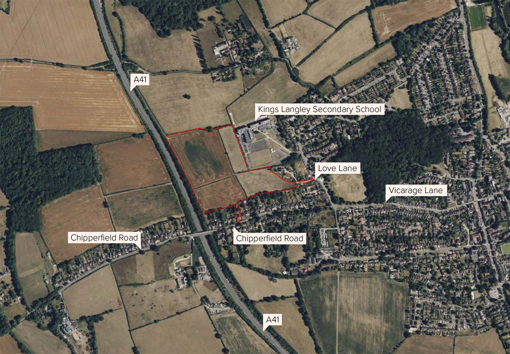
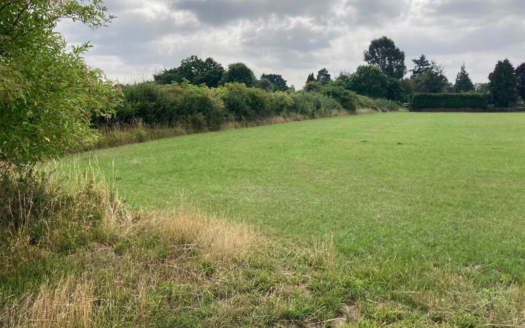
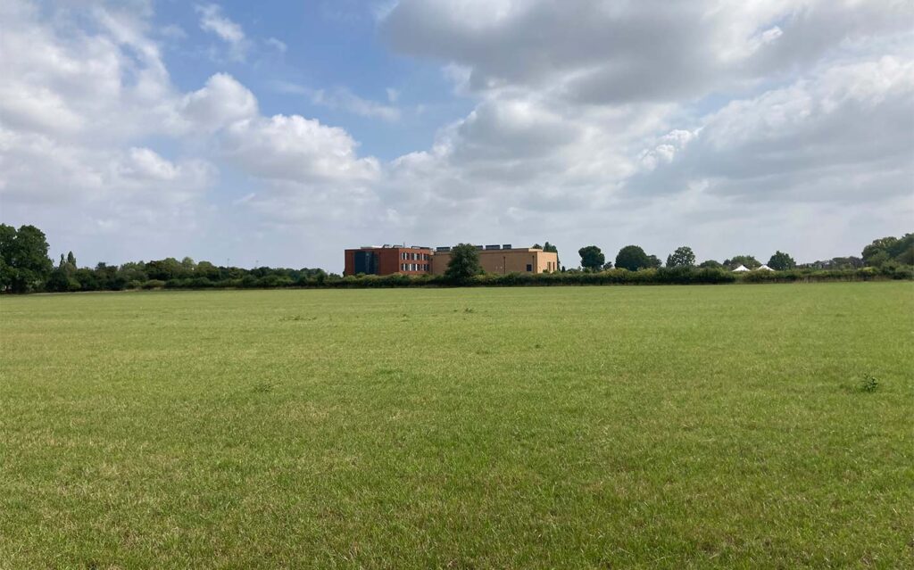
The application site measures circa 9.66 hectares in size and currently is made up of open land and the existing house at 36 Chipperfield Road. Important trees and hedgerows naturally divide the site into four distinct areas, providing a sense of structure and enclosure. These will be retained where possible, as set out in the approved Parameter Plans at the Outline stage.
The site is located on the northwestern edge of Kings Langley, east of the A41 and west of Kings Langley Secondary School.
The site is in a sustainable and accessible location with the principle of development having already been established and agreed by the Council at outline stage. It benefits from close proximity to various shops, pubs and sports clubs as well as strong links to amenities along the high street less than a mile away (5-minute cycle or 15-minute walk).
The site also benefits from good public transport links including local bus stops along either side of Chipperfield Road and also on Langley Hill. Less than two miles southeast of the site (5-minute drive or 10-minute cycle) is Kings Langley Railway Station, providing convenient travel to London Euston, Milton Keynes, Hemel Hempstead and more.
Site history
Meeting the needs of the local area and wider community
In August 2025, Dacorum Borough Council’s Development Management Committee resolved to grant the Outline planning approval (under application reference 25/00143/MOA), establishing the principle of development for the site.
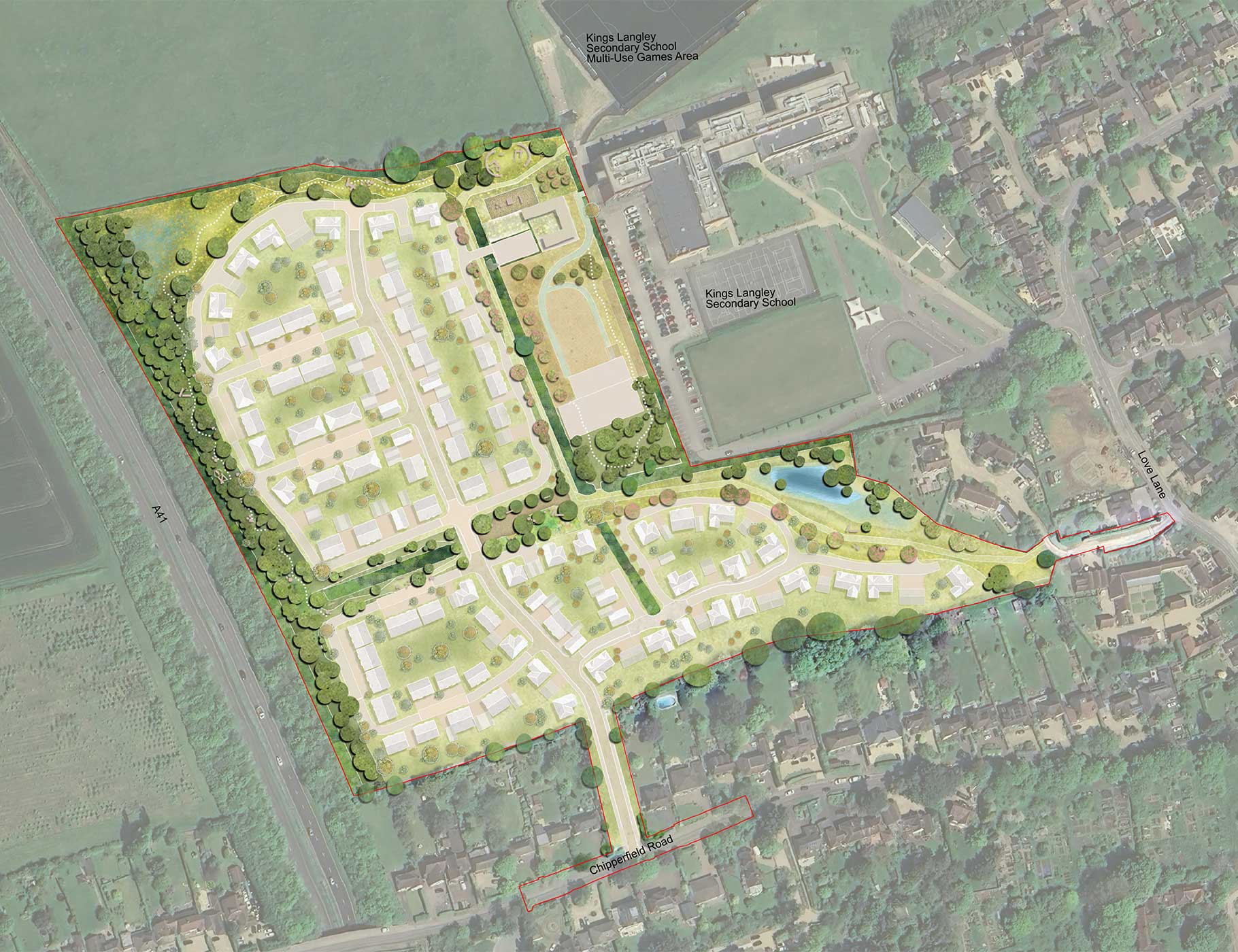
The application secured access via Chipperfield Road through the removal of the dwelling at 36 Chipperfield Road. The application establishes the principle of 150 new high-quality homes, including 50% affordable housing, the Farmstead, play scape, landscaping and sustainable access.
Extensive consultation was undertaken with the local community whilst preparing the Outline Planning Application, including school engagement, stakeholder meetings and wider community engagement, to ensure the proposals met the needs of the local area and its residents.
What’s next?
- Engaging on the detailed plans with the Parish and Borough Councils and local community.
- Submitting a Reserved Matters Application to Dacorum Borough Council following a full review of feedback received.
 Planning application boundary
Parameter plans
Key principles for the development
As part of the Outline Planning Application, a series of Parameter Plans were submitted, informed by a series of technical assessments and placemaking principles. These plans establish key principles for the development, including:
- The maximum number of new homes.
- Land uses: residential, public open space, private open space and location of drainage features.
- Maximum building heights.
- Vehicular and pedestrian access points into the development.
The plans below demonstrate how the boundaries of land use have been established at Outline stage.

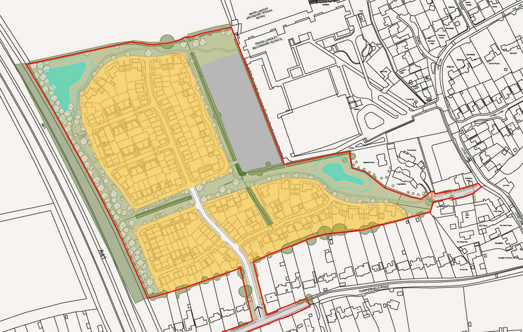
 Residential (use Class c3)
 Public open space
 Private open space
 Indicative locations of attenuation basins
- Planning application boundary
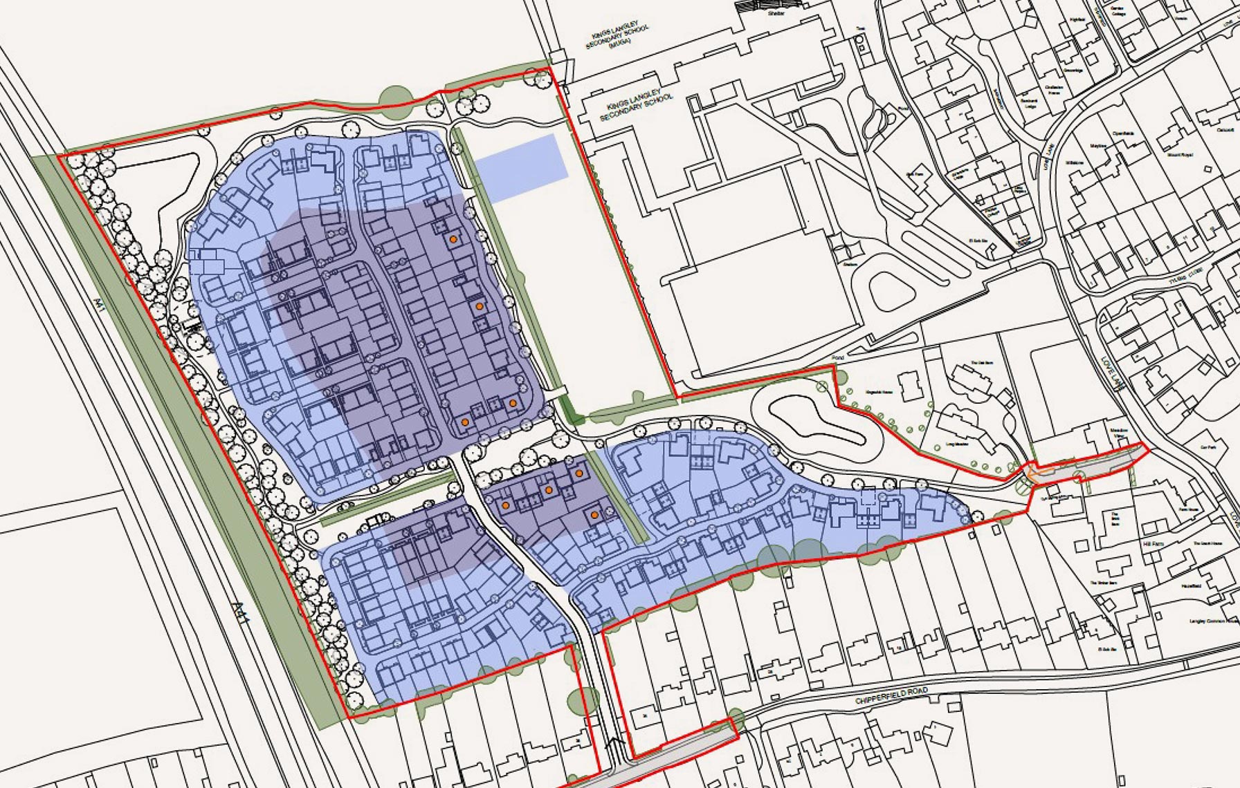
 Up to 2 storeys
 Up to 2 storeys with occasional buildings of up to 2.5 storeys
 Planning application boundary
 Potential 2.5 storey building